

")
Tropical Cyclone 01B (Mocha) / Invest 92S
Friday, May 12, 2023
Current Snapshot
For all the latest updates visit: DisasterAWARE

pdcmocha

01B_121200sair
01B_tracks_latest
pdc92S

20230512.190000.SH922023.ahi.himawari-9.Infrared-Gray.20kts.100p0.1p0
92S_tracks_latest
By PDC’s Senior Weather
Specialist Glenn James

Current Tropical Cyclones:
Tropical Cyclone 01B (Mocha)…is located approximately 456 NM south of Kolkata, India
Bay of Bengal
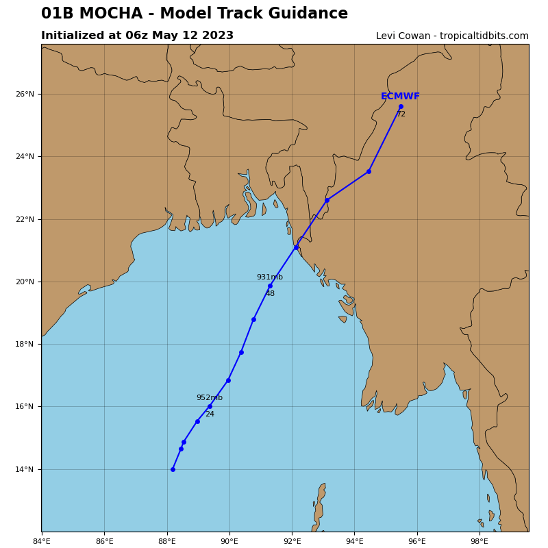
Tropical Cyclone 01B (Mocha)
According to the JTWC Warning number 9, sustained winds were 115 knots, with gusts to 140 knots.
Animated multi-spectral satellite imagery shows a highly symmetrical system with feeder bands wrapping in tightly into a deep cold dense overcast with a defined 12 NM pinhole eye.
Analysis indicates a highly favorable environment with a moderate vertical wind shear offset by strong dual outflow and warm sea surface temperatures in the Bay of Bengal.
TC Mocha will track more northeastward under the steering ridge for the remainder of the forecast, making landfall just south of the Bangladesh-Myanmar border shortly after 42 hours.
The highly favorable conditions will further fuel rapid intensification to a peak of 120 knots by 24 hours; afterward, a gradual weakening due to cooling sea surface temperatures approaching the coast.
After landfall, interaction with the rugged terrain and increasing vertical wind shear will rapidly erode the system toward dissipation by 72 hours.
South Indian Ocean
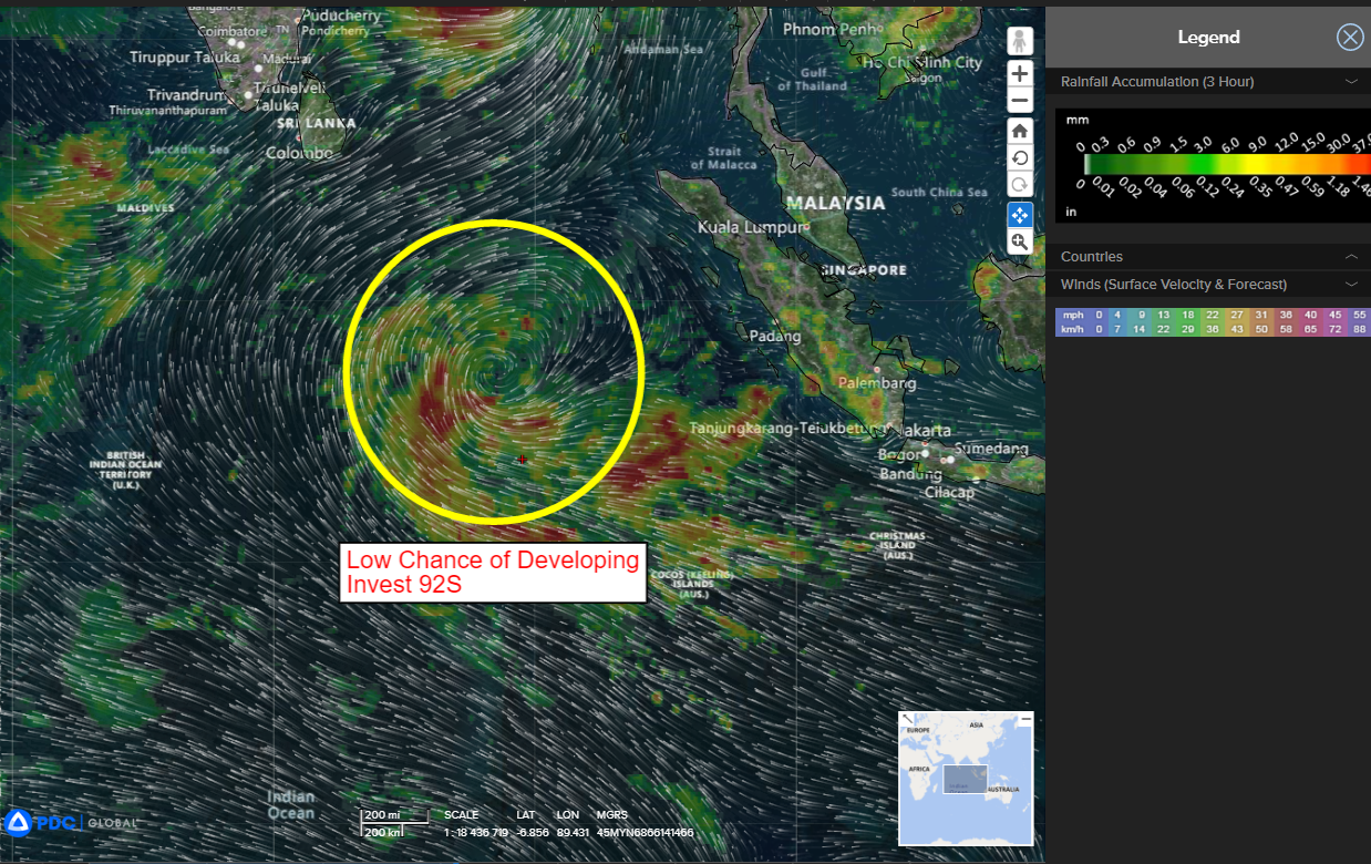
>>> There’s an area of disturbed weather being referred to as Invest 92S…which is located approximately 894 NM east-northeast of Diego Garcia
Enhanced infrared satellite imagery depicts broad mid-to-high level
cyclonic turning, with building convection over an assessed low level
circulation (llc). In addition, there’s evidence of low level turning with fragmented banding associated with isolated thunderstorm activity.
Environmental analysis shows that 92S is in a marginally favorable environment for development defined by strong westward and poleward outflow aloft, an impressive vorticity signature, moderate (15-25 knot) vertical wind shear, and warm sea surface temperatures.
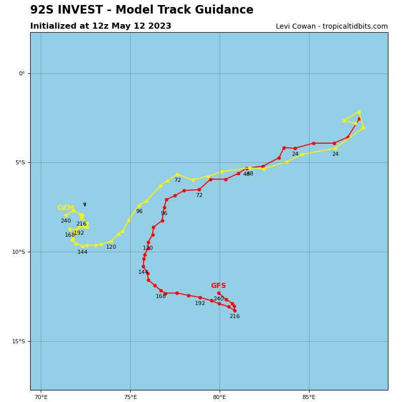
The GFS, NAVGEM, and CMC deterministic models, along with a few GEFS ensemble members, indicate a developing tropical system within 36-48 hours. Whereas the EC and icon deterministic models, along with a number of ECENS ensemble members, show a developing tropical system after 48 hours.
Maximum sustained surface winds are estimated at 15 to 20 knots.
The potential for the development of a significant tropical cyclone within the next 24 hours is low.
