

")
Invest 96S / Invest 97S
Monday, March 27, 2023
Current Snapshot
For all the latest updates visit: DisasterAWARE
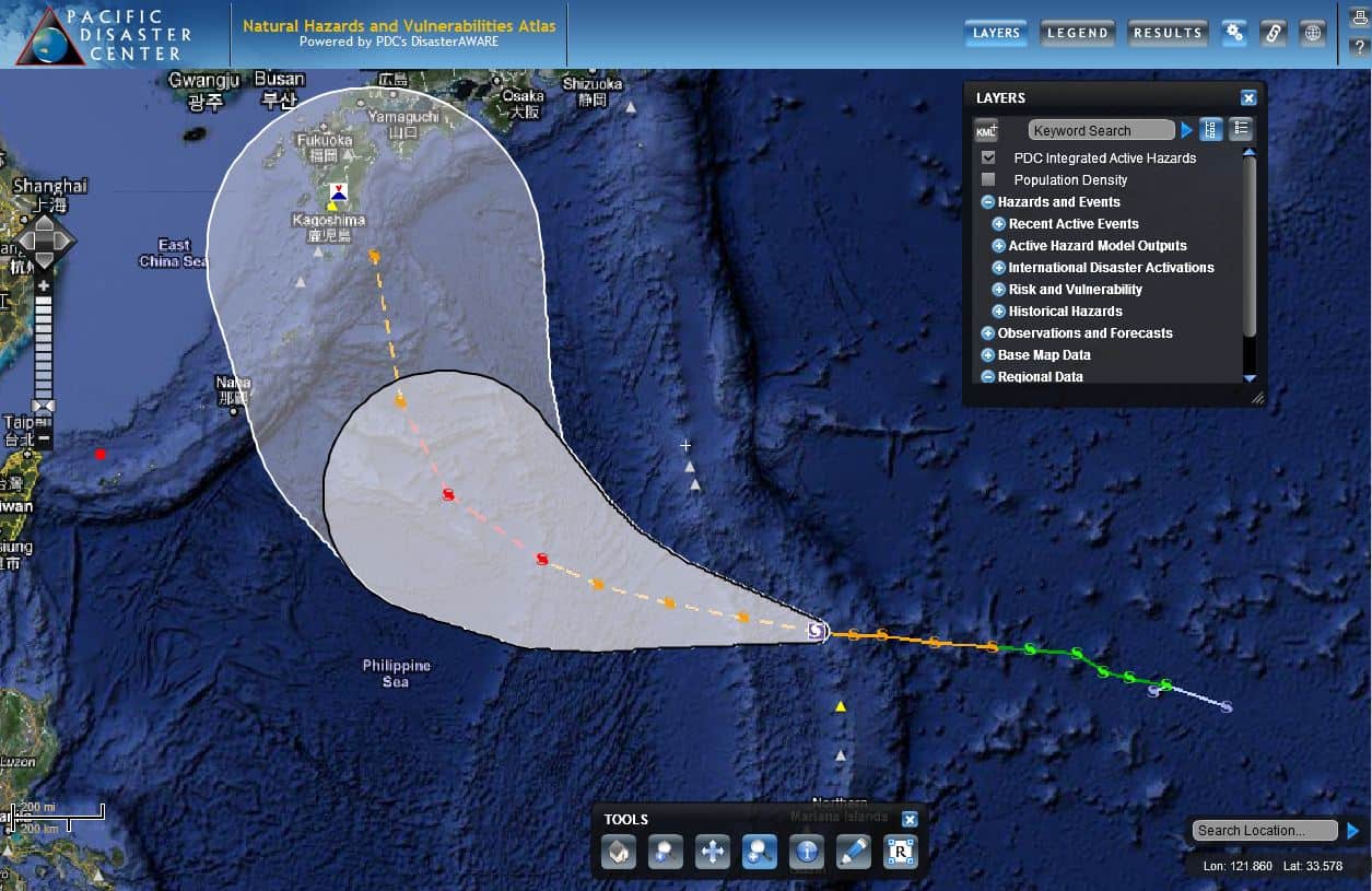
2011-07-14-atlas-08W
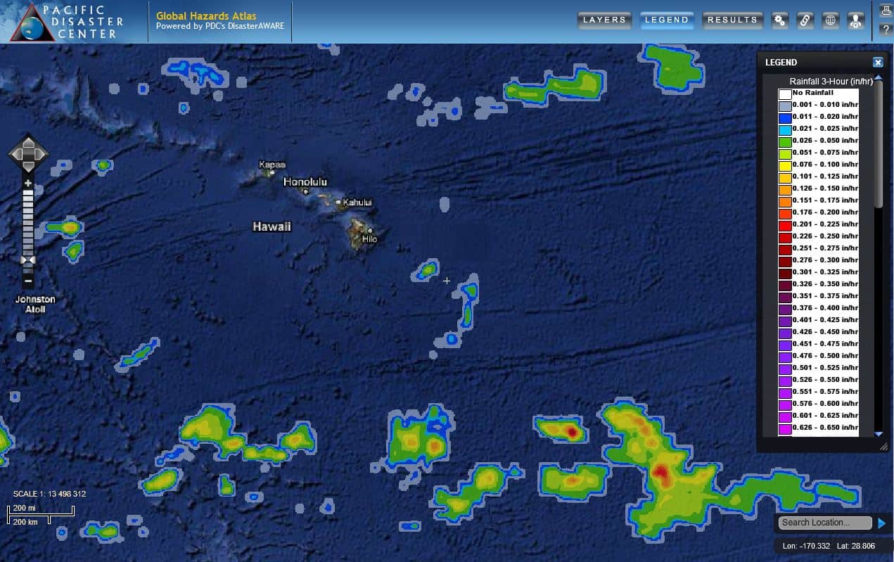
Pacific Disaster Center’s Natural Hazards and Vulnerabilities Atlas (https://wwwwww.pdc.org/atlas)
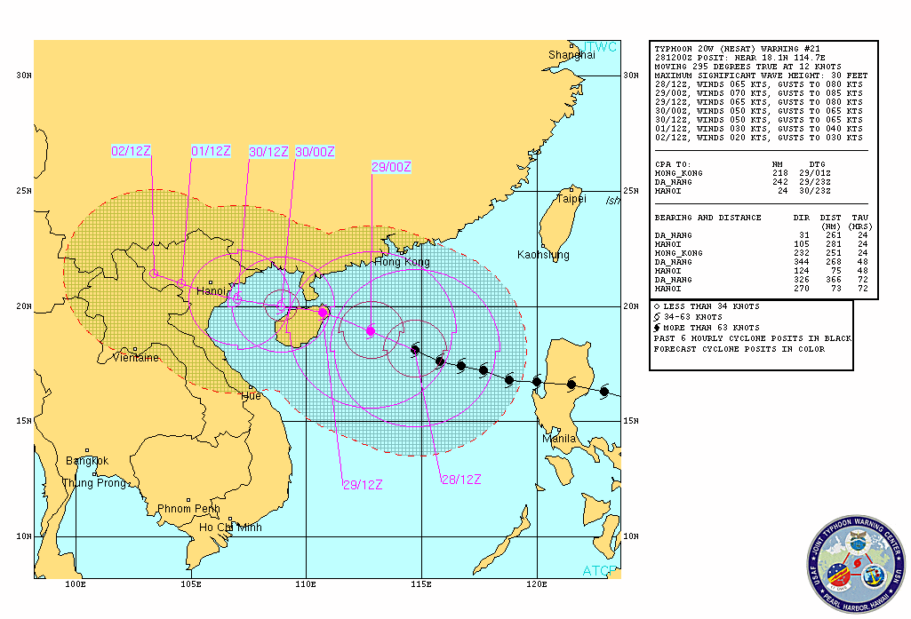
Nesat
Ophelia / Phillipe
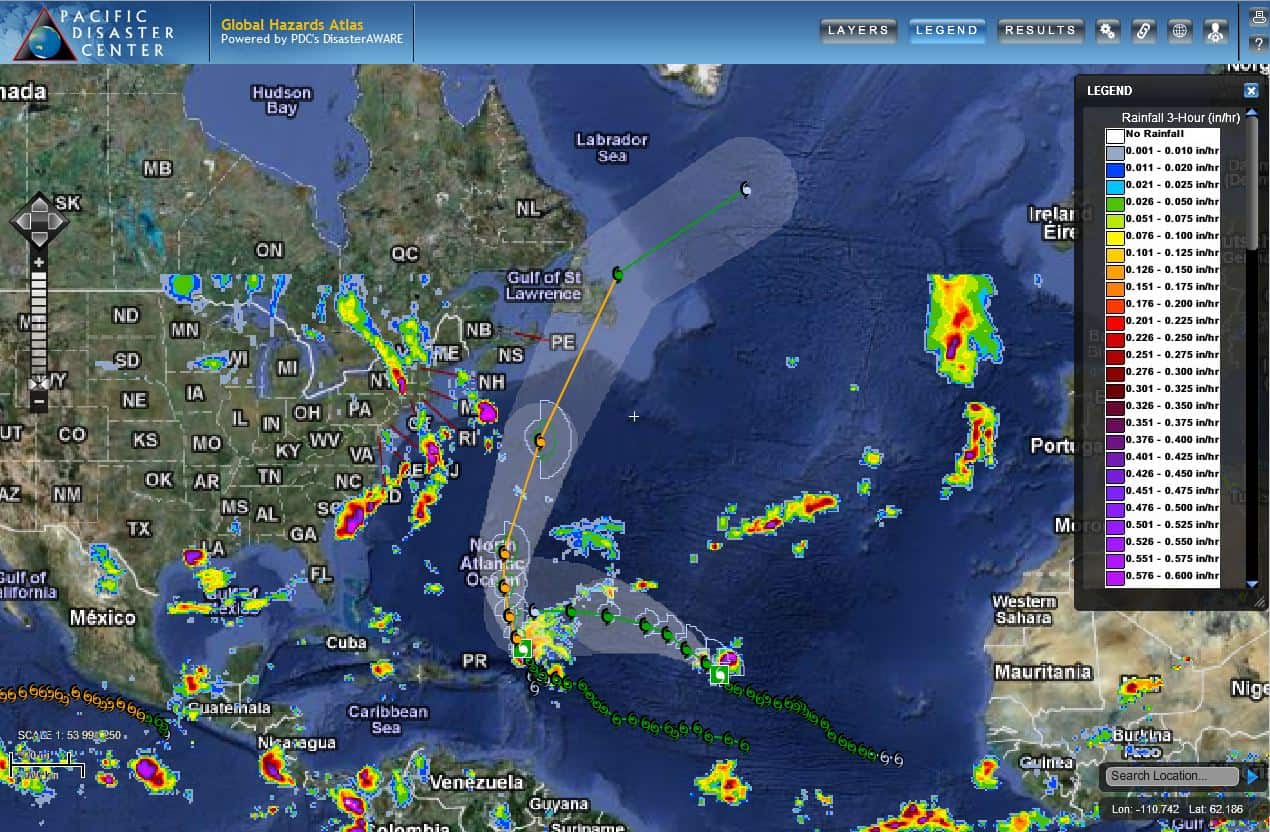
Atlantic
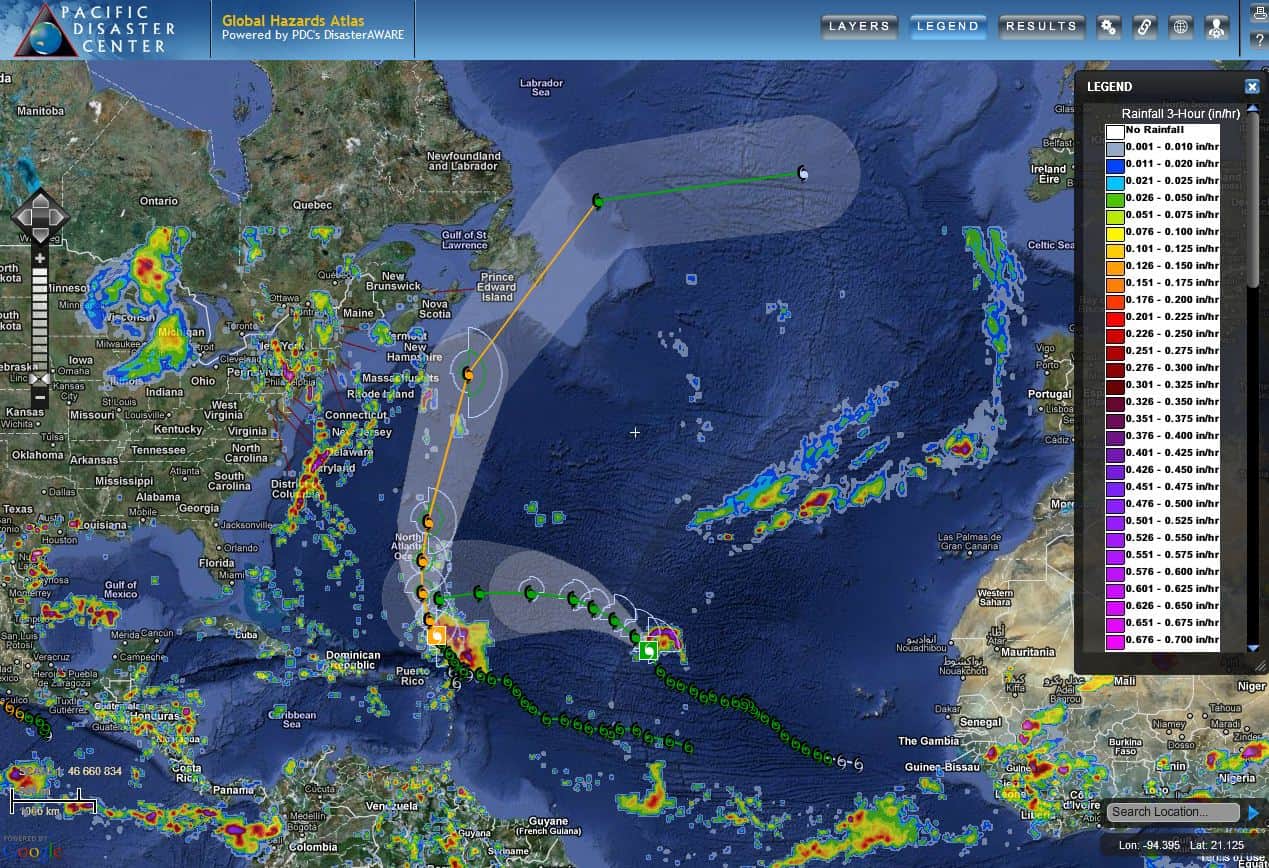
PDC Atlas
PDC Atlas showing tropical cyclones Philippe and Ophelia – track maps, TRMM rainfall, storm winds…all in the Atlantic Ocean Basin
PDC Atlas
PDC Atlas showing the Hawaiian Islands, with TRMM rainfall
By PDC’s Senior Weather
Specialist Glenn James

Current Tropical Cyclones:
There are no tropical cyclones
>>> There’s an area of disturbed weather being referred to as Invest 96S…which is located approximately 16 NM north-northwest of Cocos Island, Australia
Animated enhanced infrared imagery depict a fully obscured low level circulation, with flaring convection to the north.
Upper level analysis shows that 96S is currently in a favorable environment for development with strong polar outflow, warm sea surface temperatures offset with high (25-30 knot) vertical wind shear.
Global models are in general agreement that 96s will track southeastward and may continue to develop over the next 48 hours.
Maximum sustained surface winds are estimated at 23 to 27 knots.
The potential for transition into a significant tropical cyclone within the next 24 hours is medium.
>>> There’s a second area of disturbed weather being referred to as Invest 97S…which is located approximately 175 NM north of Port Mathurin, Mauritius
Animated enhanced infrared imagery depict fully exposed low level circulation with upper level convection sheared to the east.
Upper level analysis shows that 97S is currently in a favorable environment for development, with strong polar outflow, low (10-15 knot) vertical wind shear and warm sea surface temperatures.
Global models are in generally good agreement that 97S will track southwestward and may continue to develop over the next 48 hours.
Maximum sustained surface winds are estimated at 23 to 27 knots.
The potential for transition into a significant tropical cyclone within the next 24 hours is low.
