

")
Current Snapshot
For all the latest updates visit: DisasterAWARE
31P
31P_191200sair

himawari9_ir_31P_202504191340_lat-12.7-lon141.0
31P_tracks_latest
By PDC’s Senior Weather
Specialist Glenn James

The Pacific Disaster Center’s (PDC Global) Saturday, April 19, 2025, Tropical Cyclone Activity Report…for the Pacific Ocean, the Indian Ocean, and adjacent Seas
Current Tropical Cyclones:
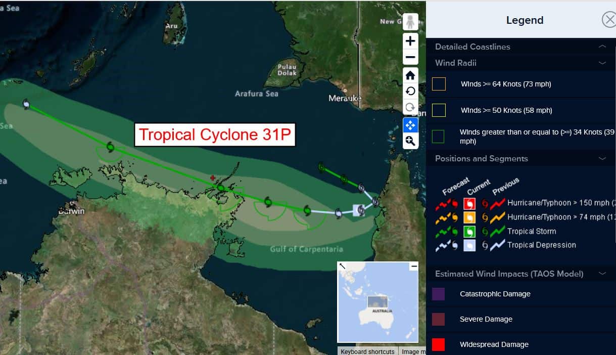
Tropical Cyclone 31P…is located approximately 384 NM northwest of Cairns, Australia
Northeast Pacific Ocean: There are no Tropical Cyclones
The last regularly scheduled Tropical Cyclone Activity Report of the 2024 eastern North Pacific Hurricane Season has been issued. Routine issuance of this section of the PDC product will resume on May 15, 2025. During the off-season, Special Tropical Weather Outlooks will be issued as conditions warrant by the NHC.
Central Pacific Ocean: There are no Tropical Cyclones
The 2024 central North Pacific hurricane season has ended. As such, the final routine Tropical Cyclone Activity Report for the 2024 season has been issued. Routine issuance of this section of the PDC product will resume on June 1, 2025. During the off-season, Special Tropical Weather Outlooks will be issued as conditions warrant by the CPHC.
Western Pacific, Indian Ocean, and adjacent Seas:
Southwest Pacific Ocean
Tropical Cyclone 31P
According to the JTWC Warning number 8, sustained winds are 30 knots, with gusts to 40 knots.
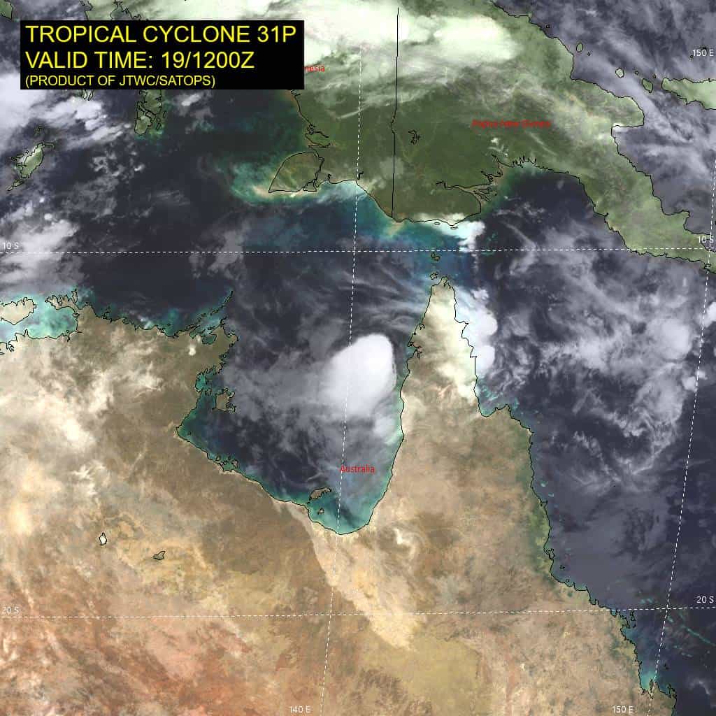
Animated multi-spectral satellite imagery depicts tropical cyclone 31P with a partially exposed low-level circulation center (llcc) and deep convection flaring along the southern semicircle. A microwave image revealed the well-defined low-level clouds bands wrapping into the center. 31P appears to have started its westward turn, evident by the southwestward jog over the past 6 hours or so. The current position is analyzed to be about 48 NM due west of Weipa, Australia.
Environmental analysis indicates that 31P is in a marginal environment characterized by weak poleward outflow aloft, moderate (15-20 knot) northeasterly vertical wind shear, slight dry air entrainment, and warm sea surface temperatures.
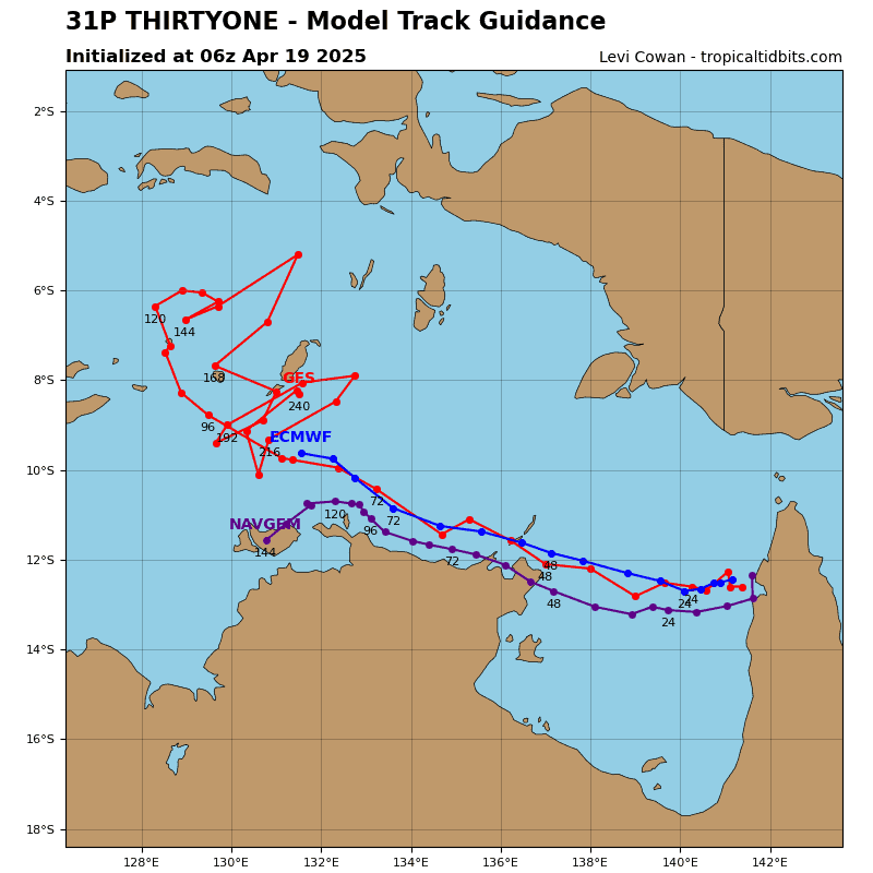
TC 31P is forecast to track west-southwestward over the next 12 hours before the str builds in to the south of the vortex and begins propagating westward. near 24 hours, the system is forecast to start on a west-northwestward track as the system rides along the northern periphery of the str through the remainder of the forecast period.
Regarding intensity, 31P is forecast to begin slightly intensifying within the Gulf of Carpentaria as the vortex becomes better aligned through the mid-levels and the environment moistens. A peak of around 40 knots is forecast to occur between 36 and 48 hours, before the system begins to skirt along the northern top
end.
After 48 hours, 31P is forecast to remain right around 35 knots through 96 hours due to land interaction and an overall marginal environment. After 96 hours, upper-level shear is expected to increase to near 25 knots, causing the vortex to further shallow and eventually dissipate near 120 hours.