

")
Current Snapshot
For all the latest updates visit: DisasterAWARE
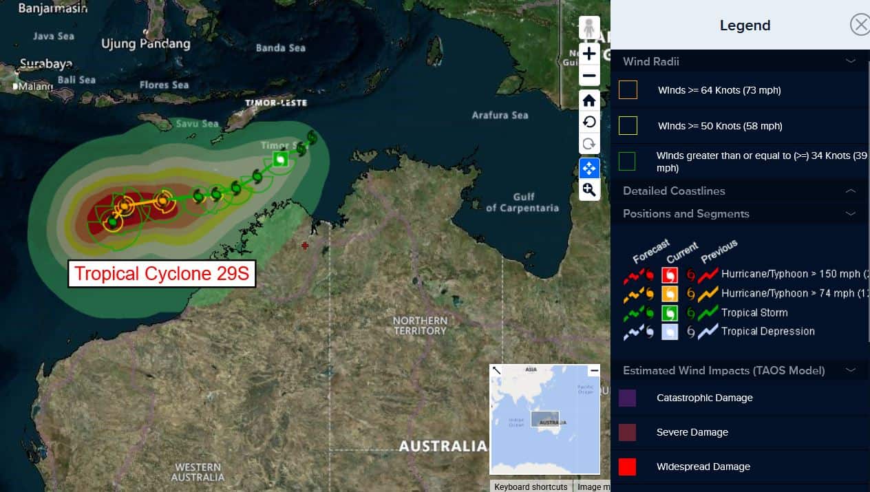
29s
29S_120600sair
himawari9_ir_29S_202504121340_lat-11.7-lon126.4
29S_tracks_latest
By PDC’s Senior Weather
Specialist Glenn James

The Pacific Disaster Center’s (PDC Global) Saturday, April 12, 2025, Tropical Cyclone Activity Report…for the Pacific Ocean, the Indian Ocean, and adjacent Seas
Current Tropical Cyclones:
Tropical Cyclone 29S…is located approximately 299 NM west of Darwin, Australia
Northeast Pacific Ocean: There are no Tropical Cyclones
The last regularly scheduled Tropical Cyclone Activity Report of the 2024 eastern North Pacific Hurricane Season has been issued. Routine issuance of this section of the PDC product will resume on May 15, 2025. During the off-season, Special Tropical Weather Outlooks will be issued as conditions warrant by the NHC.
Central Pacific Ocean: There are no Tropical Cyclones
The 2024 central North Pacific hurricane season has ended. As such, the final routine Tropical Cyclone Activity Report for the 2024 season has been issued. Routine issuance of this section of the PDC product will resume on June 1, 2025. During the off-season, Special Tropical Weather Outlooks will be issued as conditions warrant by the CPHC.
Western Pacific, Indian Ocean, and adjacent Seas:
South Indian Ocean
Tropical Cyclone 29S
According to the JTWC Warning number 6, sustained winds are 35 knots, with gusts to 45 knots.
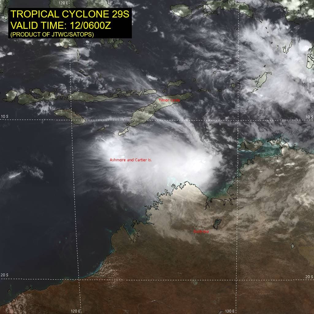
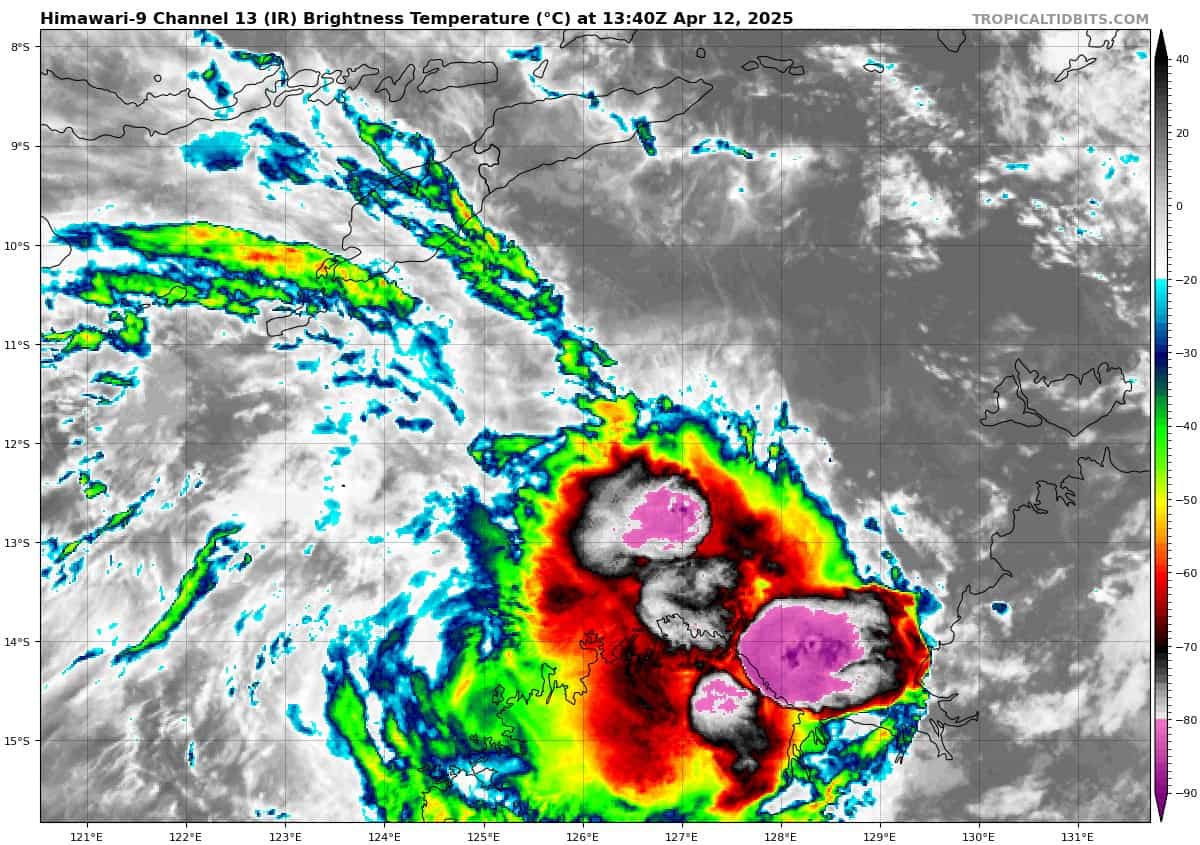
Animated multi-spectral satellite imagery depicts tropical cyclone 29S with a slightly degraded appearance compared to 6-12 hours ago. The northern portion of the circulation has become exposed and is a bit ragged, with the low-level cloud lines loosely wrapping into the center. The convection is now displaced to the southeast of the low-level circulation center (llcc) but continues to be vigorous with very cold cloud tops.
Environmental analysis indicates that 29S is in a marginally favorable environment characterized by moderate poleward outflow aloft, low (10-15 knot) deep layer shear, and warm sea surface temperatures. However, models are picking up on elevated (20-25 knot) easterly vertical wind shear, which is apparent in the animated multi-spectral.
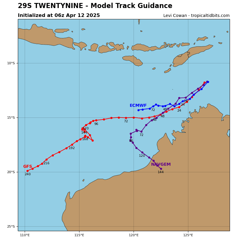
TC 29S is forecast to continue tracking west-southwestward, along the southwestern periphery of the str to the southeast through 36 hours. Near 48 hours, the steering mechanism shifts to an extension of a str off to the west-southwest. This will cause 29S to track more westward through 96 hours. Near 96 hours, an incoming long wave trough is expected to break down the ridge and cause a slow poleward track.
Regarding intensity, TC 29S is forecast to gradually intensify through 36 hours to around 50 knots due to the presence of the of the mid-level shear. After 36 hours, the mid-level shear is expected to lessen, allowing for further intensification, to a peak of around 90 knots at 96 hours.
Near 96 hours, westerly shear and dry air entrainment are expected to quickly rise in response to the incoming long wave trough. This will cause 29S to weaken throughout the remainder of the forecast period as the system becomes decapitated and sheared apart.