

")
Current Snapshot
For all the latest updates visit: DisasterAWARE
close
29S_180000sair
29S_tracks_latest
97S_172130sair
97P_tracks_latest
meteosat9_ir_99S_202504171836_lat-13.7-lon71.2
99S_tracks_latest
By PDC’s Senior Weather
Specialist Glenn James

The Pacific Disaster Center’s (PDC Global) Thursday, April 17, 2025, Tropical Cyclone Activity Report…for the Pacific Ocean, the Indian Ocean, and adjacent Seas
Current Tropical Cyclones:
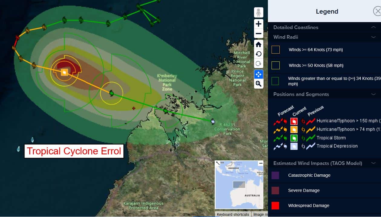
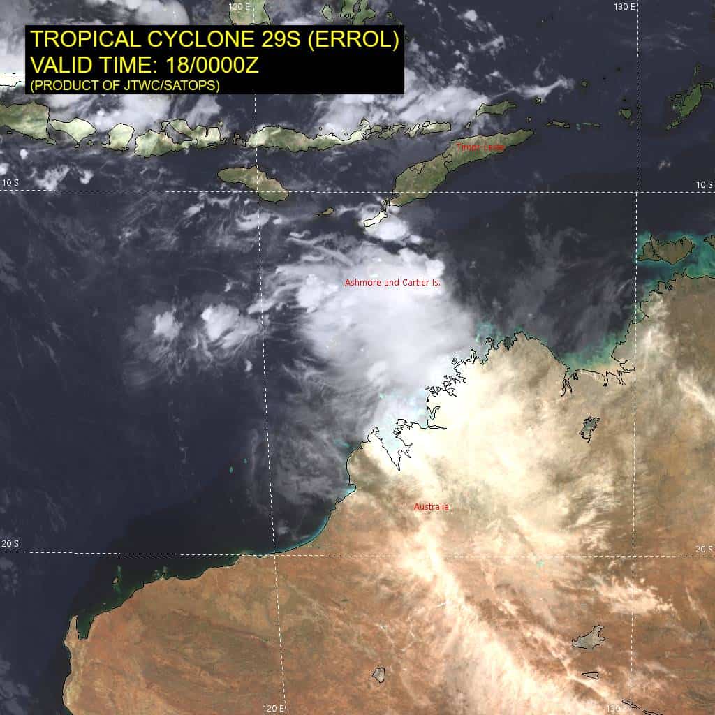
Tropical Cyclone 29S (Errol)…is located approximately 130 NM north-northeast of Broome, Australia
Northeast Pacific Ocean: There are no Tropical Cyclones
The last regularly scheduled Tropical Cyclone Activity Report of the 2024 eastern North Pacific Hurricane Season has been issued. Routine issuance of this section of the PDC product will resume on May 15, 2025. During the off-season, Special Tropical Weather Outlooks will be issued as conditions warrant by the NHC.
Central Pacific Ocean: There are no Tropical Cyclones
The 2024 central North Pacific hurricane season has ended. As such, the final routine Tropical Cyclone Activity Report for the 2024 season has been issued. Routine issuance of this section of the PDC product will resume on June 1, 2025. During the off-season, Special Tropical Weather Outlooks will be issued as conditions warrant by the CPHC.
Western Pacific, Indian Ocean, and adjacent Seas:
South Indian Ocean
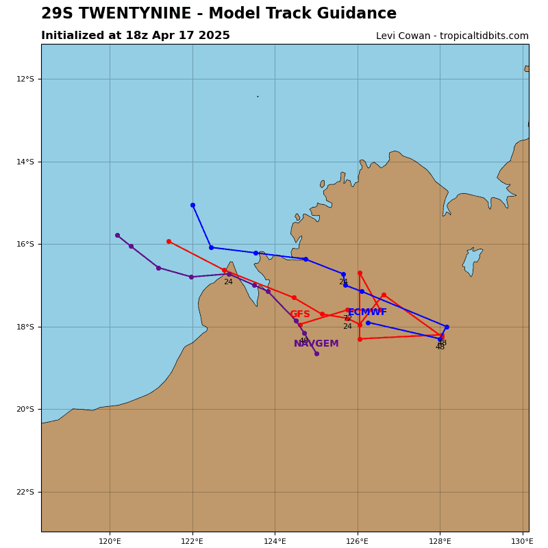
Tropical Cyclone 29S (Errol)
According to the JTWC Warning number 26, sustained winds are 55 knots, with gusts to 70 knots.
Animated enhanced infrared (eir) satellite imagery depicts tropical cyclone 29S (Errol) with a large central dense overcast (cdo) feature obscuring the low-level circulation center (llcc). A microwave image shows the deep convection being sheared toward the southeast as the strong northwesterly
shear acts on the system.
Environmental analysis indicates that 29S is in an unfavorable environment characterized by strong poleward outflow and warm sea surface temperatures greatly offset by the northwesterly shear and dry air entrainment within the western periphery.
TC 29S is forecast to track east-southeastward throughout the forecast period due to the interaction with the longwave trough to the south. Landfall is forecast to occur just after 24 hours, about 40 NM north of Derby after passing over the Dampier Peninsula.
Regarding intensity, TC 29S is forecast to continue rapidly weakening over the next 36 hours as shear values reach 30-35 knots at 24 hours and upwards of 40 knots at 36 hours. Significant dry air entrainment from the west will also aid in eroding the vortex. This will cause 29S to have weak tropical storm strength winds as it makes landfall. A drop to below 35 knots is forecast to occur no later than 36 hours as the system tracks inland and terrain interaction further diminishes the system.
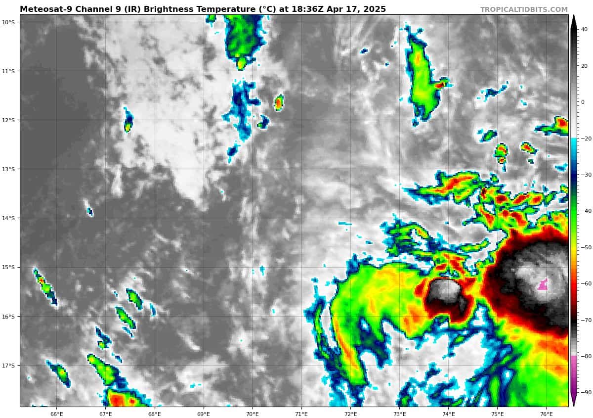
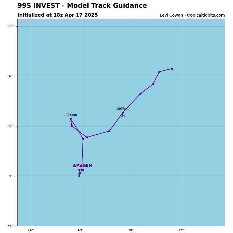
>>> An area of Disturbed weather being referred to as Invest 99S is located approximately 338 NM south of Diego Garcia
Animated enhanced infrared (eir) satellite imagery depict a poorly organized low level circulation center (llcc) with a broad area of flaring convection within the southeastern quadrant. An ascat-b image emphasizes a broad weak circulation at the surface.
Environmental analysis reveals a marginally favorable environment for development with moderate to high (20-25 knots) vertical wind shear, good poleward upper-level outflow, and warm sea surface temperatures.
Deterministic and ensemble models are in fair agreement, showing gradual intensification in the South Indian Ocean over the next 48 hours.
Maximum sustained surface winds are estimated at 18 to 23 knots.
The potential for the development of a significant tropical cyclone within the next 24 hours is low.
Southwest Pacific Ocean
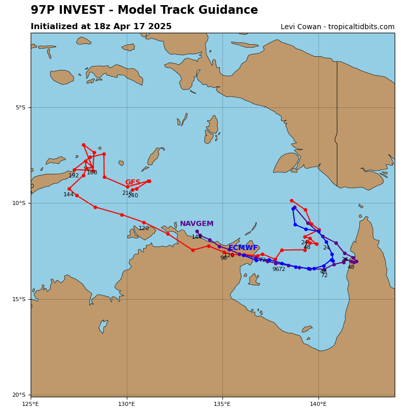
>>> An area of Disturbed weather being referred to as Invest 97P is located approximately 178 NM northeast of Gove AP, Australia
Animated enhanced infrared (eir) satellite imagery and another image depict a partially obscured, consolidating low level circulation center (llcc) with deep flaring convection and formative banding within the southwestern
quadrant.
Environmental analysis reveals a marginally favorable environment for development with moderate to high (20-25 knots) northeasterly vertical wind shear, good poleward upper-level outflow, and warm sea surface temperatures.
Deterministic and ensemble models are in good agreement, showing gradual intensification in the Gulf of Carpentaria over the next 48 hours.
Maximum sustained surface winds are estimated at 28 to 33 knots.
The potential for the development of a significant tropical cyclone within the next 24 hours is upgraded to high.