

")
Current Snapshot
For all the latest updates visit: DisasterAWARE
96p
96P_101400sair
96P_tracks_latest
By PDC’s Senior Weather
Specialist Glenn James

The Pacific Disaster Center’s (PDC Global) Thursday, April 10, 2025, Tropical Cyclone Activity Report…for the Pacific Ocean, the Indian Ocean, and adjacent Seas
Current Tropical Cyclones:
There are no tropical cyclones
Northeast Pacific Ocean: There are no Tropical Cyclones
The last regularly scheduled Tropical Cyclone Activity Report of the 2024 eastern North Pacific Hurricane Season has been issued. Routine issuance of this section of the PDC product will resume on May 15, 2025. During the off-season, Special Tropical Weather Outlooks will be issued as conditions warrant by the NHC.
Central Pacific Ocean: There are no Tropical Cyclones
The 2024 central North Pacific hurricane season has ended. As such, the final routine Tropical Cyclone Activity Report for the 2024 season has been issued. Routine issuance of this section of the PDC product will resume on June 1, 2025. During the off-season, Special Tropical Weather Outlooks will be issued as conditions warrant by the CPHC.
Western Pacific, Indian Ocean, and adjacent Seas: There are no Tropical Cyclones
South Indian Ocean
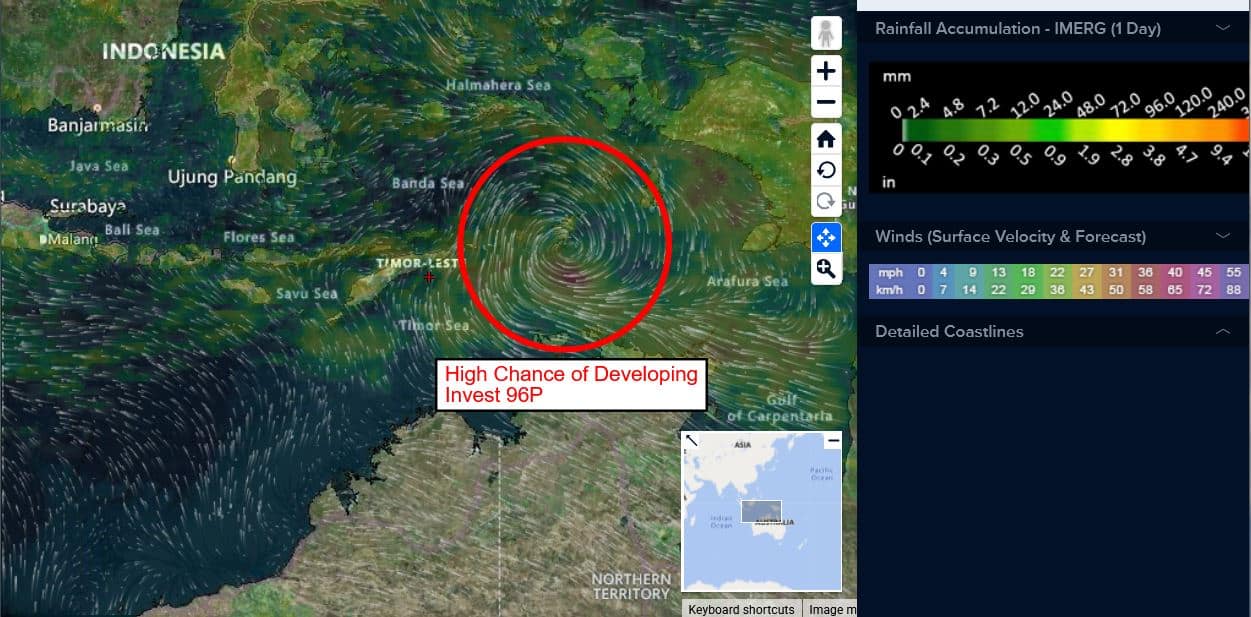
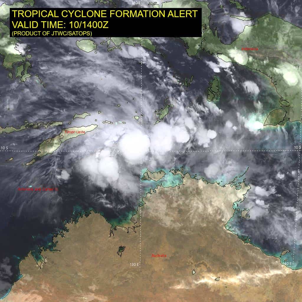
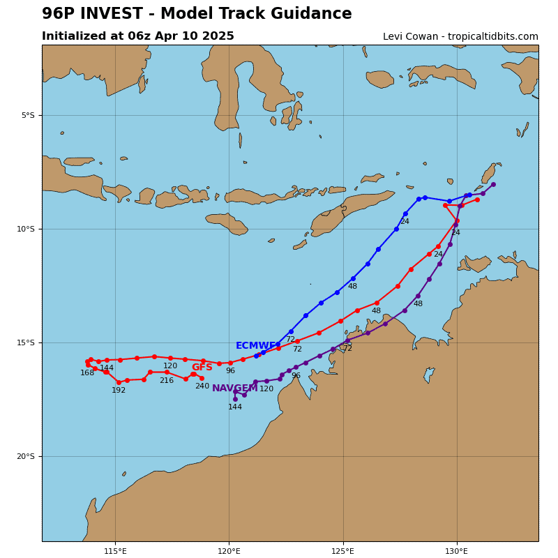
>>> There’s an area of disturbed weather that is being referred to as Invest 96P, which is located approximately 230 NM north of Darwin, Australia
Animated enhanced infrared satellite imagery depicts a consolidating low-level circulation (llc) with increasing core convection. A microwave pass shows formative convective banding over the southern semicircle. Multiple scatterometer passes indicate a defined circulation, with 20-25 knot winds over the southern semicircle.
Environmental analysis reveals a marginally favorable environment for development, with moderate to high easterly vertical wind shear (vws) of 20-25 knots offset by good westward upper-level outflow and warm sea surface temperatures.
Global models and ensembles indicate rapid development over the next 24-48 hours as the system tracks southwestward.
Maximum sustained surface winds are estimated at 25 to 30 knots.
The potential for the development of a significant tropical cyclone within the next 24 hours is remains high.