

")
Tropical Cyclone 17W / Tropical Cyclone 02P / Invest 96W
Sunday, November 12, 2023
Current Snapshot
For all the latest updates visit: DisasterAWARE

1800×1080
pdc17w
jtwc17w

tsat17w

17W_tracks_latest

pdc2

tsat96

96W_tracks_latest
91P_tracks_latest
By PDC’s Senior Weather
Specialist Glenn James

The Pacific Disaster Center’s (PDC Global) Sunday, November 12, 2023, Tropical Cyclone Activity Report…for the Pacific Ocean, the Indian Ocean, and adjacent Seas
Current Tropical Cyclones:
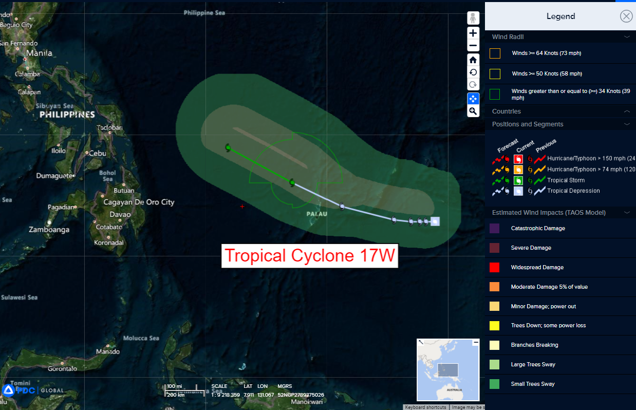
Tropical Cyclone 17W…is located approximately 144 NM south of Yap
Tropical Cyclone 02P…is located approximately 484 NM north-northeast of Port Vila, Vanuatu
Northeast Pacific Ocean:
There are no tropical cyclones, nor any areas of disturbed weather under investigation by the National Hurricane Center (NHC) at the time of this writing.
Central North Pacific:
There are no tropical cyclones, nor any areas of disturbed weather under investigation by the Central Pacific Hurricane Center (CPHC) at the time of this writing.
Western Pacific, Indian Ocean and adjacent Seas:
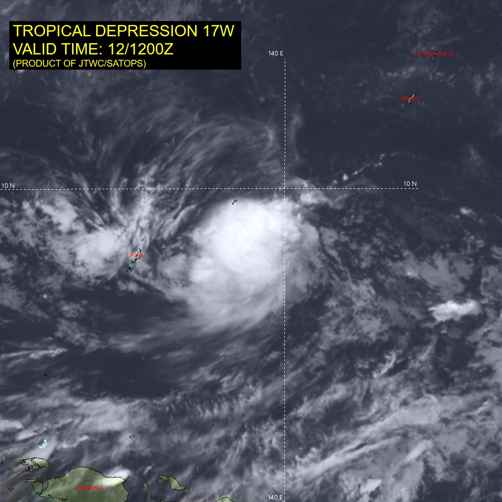
Tropical Cyclone 17W
According to the JTWC warning number 3
Sustained winds were 25 knots…with gusts to 35 knots
Animated enhanced infrared satellite imagery as well as animated visible imagery shows flaring convection firing along a line of convergence to the north of a very small low level circulation center (llcc), forming a small central dense overcast type feature.
Cirrus debris from the convective activity is obscuring the llcc, but spiral band analysis of the outer bands in the clear air to the east lent low to moderate confidence to the initial position.
A microwave image presented a rather disorganized circulation, with clear turning in the mid-level convection, but only weak turning evident in the lower levels, with a significant vortex tilt westward with height due moderate easterly shear.
The llcc is assessed to be somewhat elongated along an east-west axis suggesting the eastern edge of the circulation could be as far east as 143E, though TD 17W is located in the western side of the larger, elongated rotation.
The system sits in a somewhat marginal environment, with moderate easterly diffluent outflow aloft, low deep-layer shear but moderate to high shear in the upper-levels and a fair amount of dry air in the mid-levels.
TD 17W is expected to slowly drift westward under the influence of a generally weak steering pattern. Passage of a low- to mid-level trough to the north has resulted in development of a break in the ridge due north of the system, weakening the steering gradient such that the system will very slowly move towards the west for the first 48 hours of the forecast.
After 48 hours the ridge builds in to the north, strengthens the steering gradient, and in response TD 17W accelerates to the west-northwest. After 72 hours the system will turn more towards the northwest towards another break that develops in the subtropical ridge to the north.
Due to the rather disorganized low-level vortex structure, the continued presence of dry mid-level air and moderate easterly shear, the system will struggle to develop through the first 72 hours, with only slight intensification expected after 24 hours as the shear is expected to weaken a notch or two.
After 48 hours, TD 17W is forecast to reach tropical storm strength as it moves into a more favorable environment of slightly lower shear and enhanced mid-level moisture, but it will continue to struggle against moderate easterly shear throughout the forecast period.
Tropical Cyclone 02P
According to the JTWC warning number 1
Sustained winds were 35 knots…with gusts to 45 knots
Animated multi-spectral satellite imagery depicts a consolidating system with spiral bands of deep convection wrapping into a persistent cloud structure, obscuring the low-level circulation center (llcc).
The overall environment is assessed as favorable based on moderate radial outflow, low to moderate (10-15 knots) vertical wind shear and warm sea surface temperatures.
TC 02P is forecast to track southwestward and transit the western periphery of the subtropical ridge east of American Samoa as the cyclone nears the island of Fiji. Environmental conditions over the next 48 hours will remain favorable, characterized by warm sea surface temperatures, moderate radial divergence aloft and low-moderate vertical wind shear (10-15 knots).
These favorable conditions will fuel steady intensification to allow TC 02P to reach a potential maximum intensity of 55 knots, possibly higher, between 36 and 48 hours. However, by 72 hours, increasing vertical wind shear and dry air entrainment will begin to weaken the system. Additionally, 02P will begin subtropical transition as the system crosses poleward cooler water along with high vertical wind shear associated with the subtropical jetstream. By 120 hours, TC 02P is expected to transition to an asymmetric warm core with an expansive wind field.
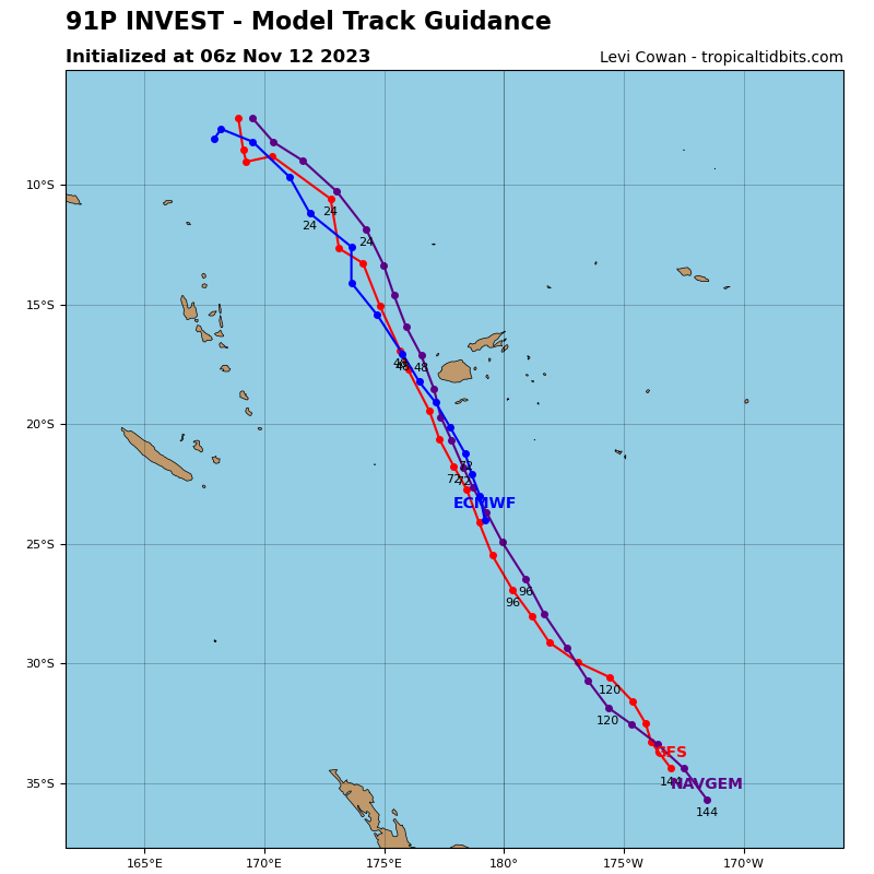
>>> There’s an area of disturbed weather being referred to as Invest 96W…which is located approximately 300 NM east of Kosrae
Animated multi-spectral satellite imagery and a himawari-9 visible image depict a broad area of turning with formative shallow bands of convection wrapping into a consolidating llcc.
Environmental analysis indicates 96W is in a favorable environment for development with good upper-level divergence, high sea surface temperatures, and low vertical wind shear (5-10 knots).
Global numerical model guidance is in fair agreement that 96W will continue to consolidate and further develop as it tracks west-northwestward over the next 24 hours.
Maximum sustained surface winds are estimated at 15 to 20 knots.
The potential for the development of a significant tropical cyclone within the next 24 hours is low.
