

")
Current Snapshot
For all the latest updates visit: DisasterAWARE
29S
rrrr
29S_150600sair
himawari9_ir_29S_202504151340_lat-13.9-lon120.8
29S_tracks_latest
By PDC’s Senior Weather
Specialist Glenn James

The Pacific Disaster Center’s (PDC Global) Tuesday, April 15, 2025, Tropical Cyclone Activity Report…for the Pacific Ocean, the Indian Ocean, and adjacent Seas
Current Tropical Cyclones:
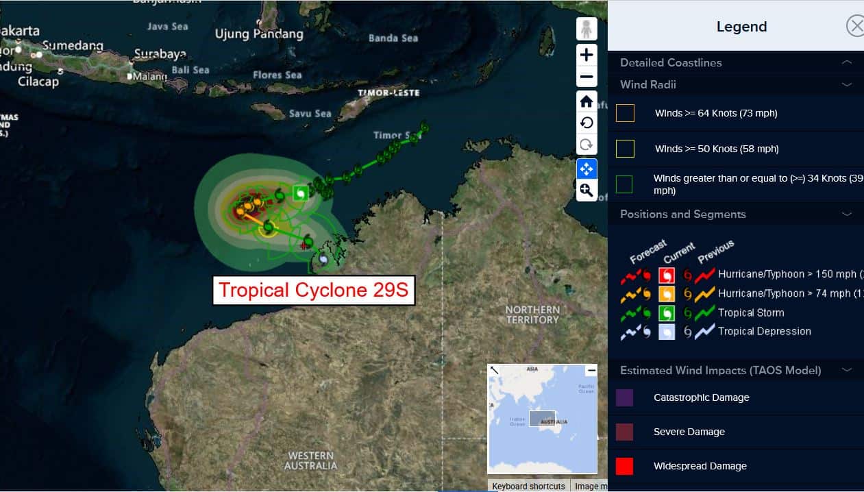
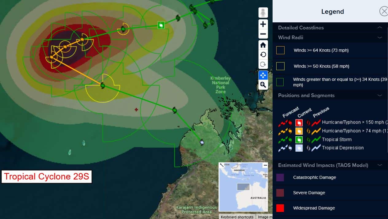
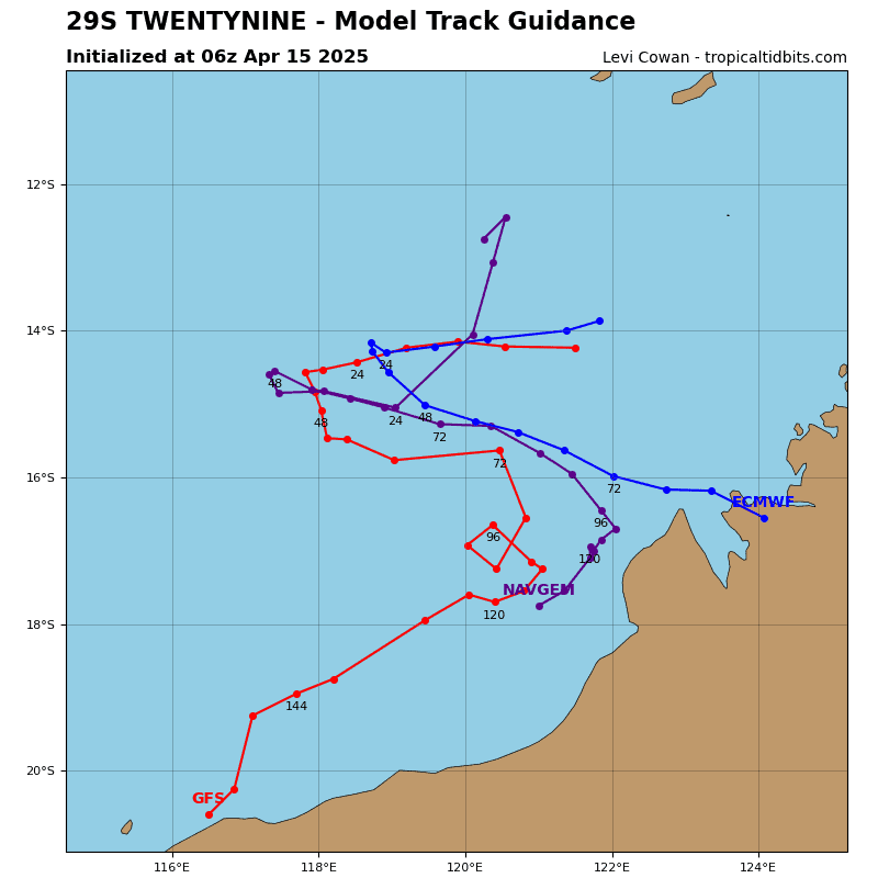
Tropical Cyclone 29S (Errol)…is located approximately 270 NM north-northwest of Broome, Australia
Northeast Pacific Ocean: There are no Tropical Cyclones
The last regularly scheduled Tropical Cyclone Activity Report of the 2024 eastern North Pacific Hurricane Season has been issued. Routine issuance of this section of the PDC product will resume on May 15, 2025. During the off-season, Special Tropical Weather Outlooks will be issued as conditions warrant by the NHC.
Central Pacific Ocean: There are no Tropical Cyclones
The 2024 central North Pacific hurricane season has ended. As such, the final routine Tropical Cyclone Activity Report for the 2024 season has been issued. Routine issuance of this section of the PDC product will resume on June 1, 2025. During the off-season, Special Tropical Weather Outlooks will be issued as conditions warrant by the CPHC.
Western Pacific, Indian Ocean, and adjacent Seas:
South Indian Ocean
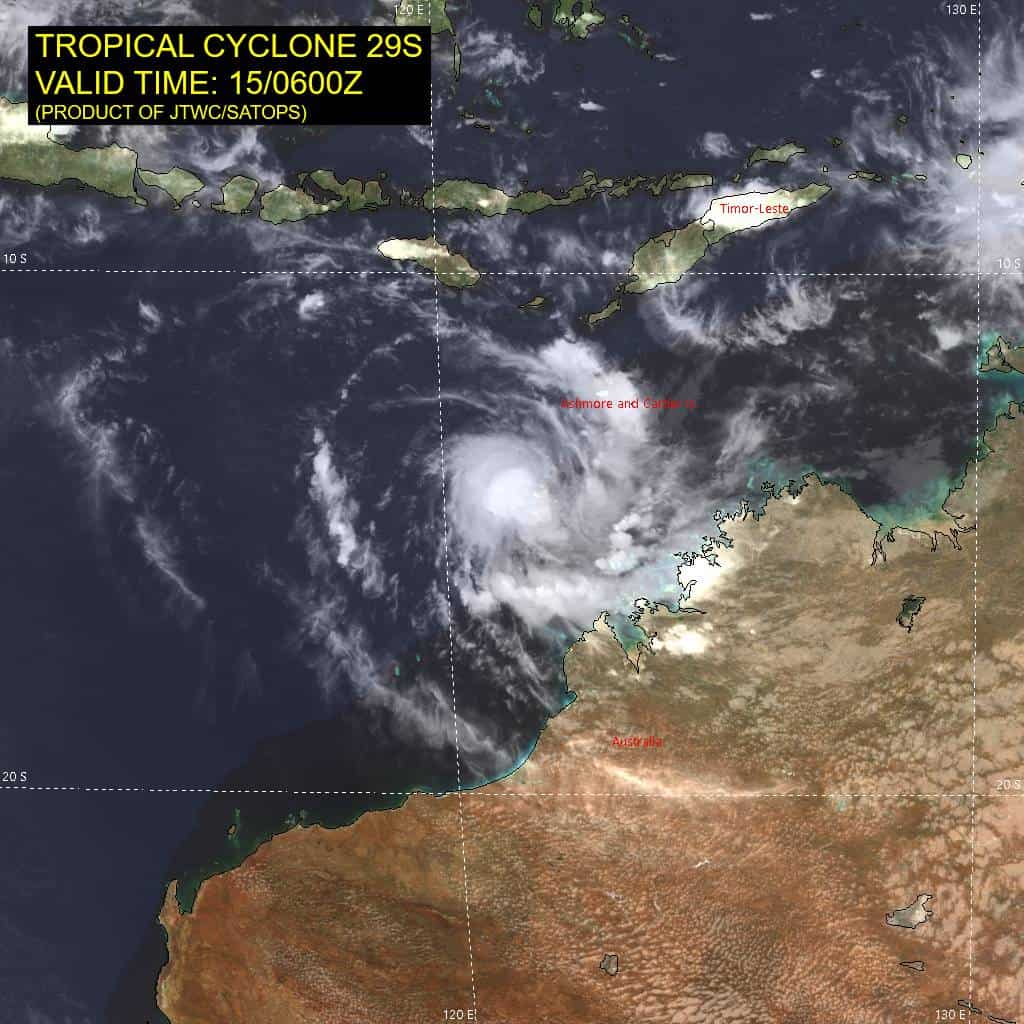
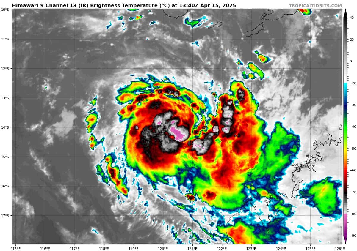
Tropical Cyclone 29S (Errol)
According to the JTWC Warning number 18, sustained winds are 80 knots, with gusts to 100 knots.
Animated enhanced infrared (eir) satellite imagery depicts a very compact system, with deep convection pulsing near then assessed low level circulation center (llcc). Earlier visible imagery depicted a partially exposed llcc, but subsequent visible imagery close to local sunset, as well as a microwave image suggests the llcc has tucked up under a very small central dense overcast (cdo) feature. so far, pockets of flaring deep convective have remained relatively disorganized but are starting to show signs of developing into a more persistent cdo.
Analysis reveals a favorable environment. The system is situated roughly along the upper-level ridge axis, with good westward and poleward outflow, enhanced by a shortwave trough positioned just east of Port Hedland. Shear is light and ssts are quite warm, and all that is required for explosive development is a bit more axisymmetrization to occur.
TC 29S is currently drifting westward along the northern side of an extension of the str which extends from south of Darwin to a center southwest of Cocos Island. This general westward motion is expected to continue through the next 24 hours, before the approach of a deep trough will begin to erode and ultimately break down the ridge, allowing TC 29S to both slow down and begin a poleward turn around 36 hours.
In terms of intensity, TC 29S is expected to achieve vortex symmetrization within the next six hours or so, setting the stage for explosive development. The forecast calls for rapid intensification (ri) to begin prior to 12 hours, with the system intensifying up to a peak of at least 105 knots by 36 hours under very favorable environmental conditions. Some models indicate the potential for a peak intensity of 10-15 knots higher and this is certainly possible due to environment and the small, compact nature of the system, which lends itself to dramatic periods of ri.
However, the party will be short-lived, as shear is expected to rapidly increase immediately after the system reaches peak intensity, with model fields suggesting a 30 knot increase in shear between 36 hours and 60 hours. The system will quickly be decapitated by these high shear values and as the vortex shallows out and weakens, the system will turn sharply southeastward, along the leading edge of a deep trough moving in from the west.
By the end of the forecast, the system will begin to turn southward and eventually southwestward along the lower-level flow pattern. The exact timing of this turn will determine whether it occurs offshore or onshore and there is considerable uncertainty in this phase of the forecast. Regardless of where it occurs, the system will dissipate as a tropical cyclone between 96 and 120 hours.
Southwest Pacific Ocean
>>> An area of Disturbed weather being referred to as Invest 97P is located approximately 337 NM northeast of Darwin, Australia
Animated multi-spectral satellite (msi) imagery and a microwave image depict a slowly consolidating, partially exposed low level circulation center (llcc) with formative convective banding along the southern periphery of the llcc. A recent observation from Cape Wessel, Australia indicates sustained easterly winds of 19 knots.
Environmental analysis reveals a marginally favorable environment for development with low vertical wind shear (vws) of 10-15 knots, weak upper-level outflow and warm sea surface temperatures (sst).
Deterministic and ensemble models are in agreement, portraying slow development over the next 24 to 48 hours.
Maximum sustained surface winds are estimated at 20 to 25 knots.
The potential for the development of a significant tropical cyclone within the next 24
hours is low.
>>> An area of Disturbed weather being referred to as Remnants of 30P is located approximately 780 NM north of Auckland, New Zealand
The system is currently classified as a subtropical storm, generally characterized as having both tropical and mid-latitude cyclone features. Subtropical storm 30P has tracked under the subtropical jet, with strong vertical wind shear and extensive dry air entrainment, and is merging with a large subtropical low.
Animated multi-spectral satellite (msi) imagery and a microwave image depict a partially exposed low level circulation center (llcc) with the bulk of the convection sheared east and
poleward.
Upper-level analysis reveals an unfavorable environment for tropical development with high vertical wind shear (vws) of 40-45 knots, poor upper-level outflow and marginal sea surface temperatures .
Deterministic and ensemble models are in agreement that the system will continue to strengthen as it merges with the subtropical low to the west and tracks southwestward. this system is expected to generate extensive storm force winds over the next 24 to
48 hours.
Maximum sustained surface winds are estimated at 45 to 50 knots.
The potential for the development of a significant tropical cyclone within the next 24 hours is low.