

")
Current Snapshot
For all the latest updates visit: DisasterAWARE

96p
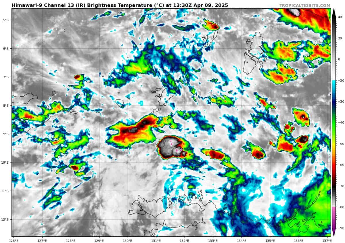
himawari9_ir_96P_202504091330_lat-8.8-lon131.9
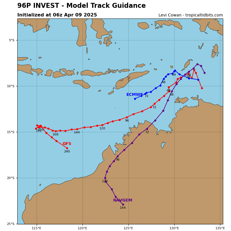
96P_tracks_latest
By PDC’s Senior Weather
Specialist Glenn James

The Pacific Disaster Center’s (PDC Global) Wednesday, April 9, 2025, Tropical Cyclone Activity Report…for the Pacific Ocean, the Indian Ocean, and adjacent Seas
Current Tropical Cyclones:
There are no tropical cyclones
Northeast Pacific Ocean: There are no Tropical Cyclones
The last regularly scheduled Tropical Cyclone Activity Report of the 2024 eastern North Pacific Hurricane Season has been issued. Routine issuance of this section of the PDC product will resume on May 15, 2025. During the off-season, Special Tropical Weather Outlooks will be issued as conditions warrant by the NHC.
Central Pacific Ocean: There are no Tropical Cyclones
The 2024 central North Pacific hurricane season has ended. As such, the final routine Tropical Cyclone Activity Report for the 2024 season has been issued. Routine issuance of this section of the PDC product will resume on June 1, 2025. During the off-season, Special Tropical Weather Outlooks will be issued as conditions warrant by the CPHC.
Western Pacific, Indian Ocean, and adjacent Seas: There are no Tropical Cyclones
Southwest Pacific Ocean
>>> There’s an area of disturbed weather that is being referred to as Invest 96P, which is located approximately 230 NM north-northeast of Darwin, Australia
Animated enhanced infrared satellite imagery depicts a broad area of persistent convection displaced to the southeast of a disorganized low-level circulation center (llcc). A microwave image revealed weak low-level banding within the northern periphery of the system. Surface observations at Mccluer Island are reporting around 20 knots from the east-southeast.
Environmental analysis indicates that 96P is in a favorable environment for development with low (5-10 knot) vertical wind shear, warm sea surface temperatures, and good upper-level outflow.
The gfs shows a quick intensification trend, attaining tropical storm strength within 48 hours while the ecmwf shows a more gradual trend. model guidance agrees on a southwestward track, near the northwestern coast of Australia as the system develops.
Maximum sustained surface winds are estimated at 23 to 28 knots.
The potential for the development of a significant tropical cyclone within the next 24 hours remains medium.